
As per YIMBY Melbourne’s 2024 research note, Upper-level setbacks delenda est, upper-level setbacks:
The common-sense removal of upper-level setback requirements represents a planning ethos that respects evidence over established legacy planning norms, and represents the profession’s willingness to evolve to meet the challenges of today.
As we face long-term fuel cost uncertainty, it is critical that we enable more homes to be built near jobs and public transport. In a high-cost era, we cannot afford the long delays of arbitrary processes—and that is exactly what the Mid-Rise Code, like its predecessor the Townhouse Code, seeks to overcome.
The mid-rise code only applies to a very small amount of Melbourne’s land. But we know that the broader the upzoning, the more effective it is.
Should the code prove effective, the government should expand its applicability by expanding the Residential Growth Zone and establishing Activity Centres around more of Melbourne’s train stations.
Previous YIMBY Melbourne analysis indicates that an additional 50 train stations would be strong candidates for more Activity Centres, bringing the total to 100.
“YIMBY Melbourne welcomes the Mid-Rise Code, and congratulates the Department of Transport and Planning for listening to the evidence on upper-level setbacks.”
“Rules that respect the evidence are the key to a more accessible, sustainable, and affordable city.”
"This welcome change undoes decades of counterproductive arbitrary restrictions that drove up costs, reduced housing supply, and stripped our streets of life.”
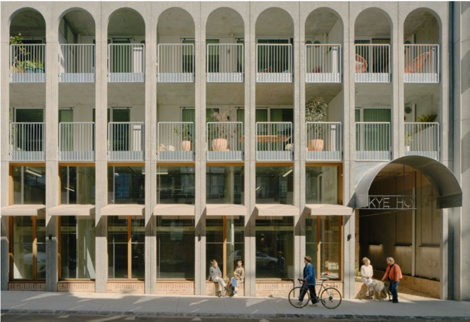
“This change goes a long way to enabling affordable, thermally efficient, and beautiful mid‑rise housing that reconnects people to the street and brings back the vibrant, walkable neighborhoods cities like Paris and Barcelona have long shown us.”
(This analysis excludes HCTZ2; MUZ included numbers are an overestimate)
All of Greater Melbourne
89.6 km² of land affected (including MUZ)
55.7 km² of land affected (excluding MUZ)
Within 30km
50.48 km² of land affected (including MUZ) — 0.58% of residentially zoned land
42.08 km² of land affected (excluding MUZ) — 0.48% of residentially zoned land